Two New 3D US Maps: Raised-Relief Geophysical and Aviation Themed US Maps Introduced by Award-Winning Mapmaker Summit Terragraphics

Martinsburg, WV (PRWEB) April 19, 2016 -- Mapmaker Summit Terragraphics has introduced the first two products in its new series of 3D raised-relief US wall maps: the 3D Geophysical US map and the 3D Major Airports & Airspace US map. A US National Parks and Trails map will follow soon.
Other thematic versions are under consideration, including maps for the education market and custom versions for businesses with multiple locations across the country.
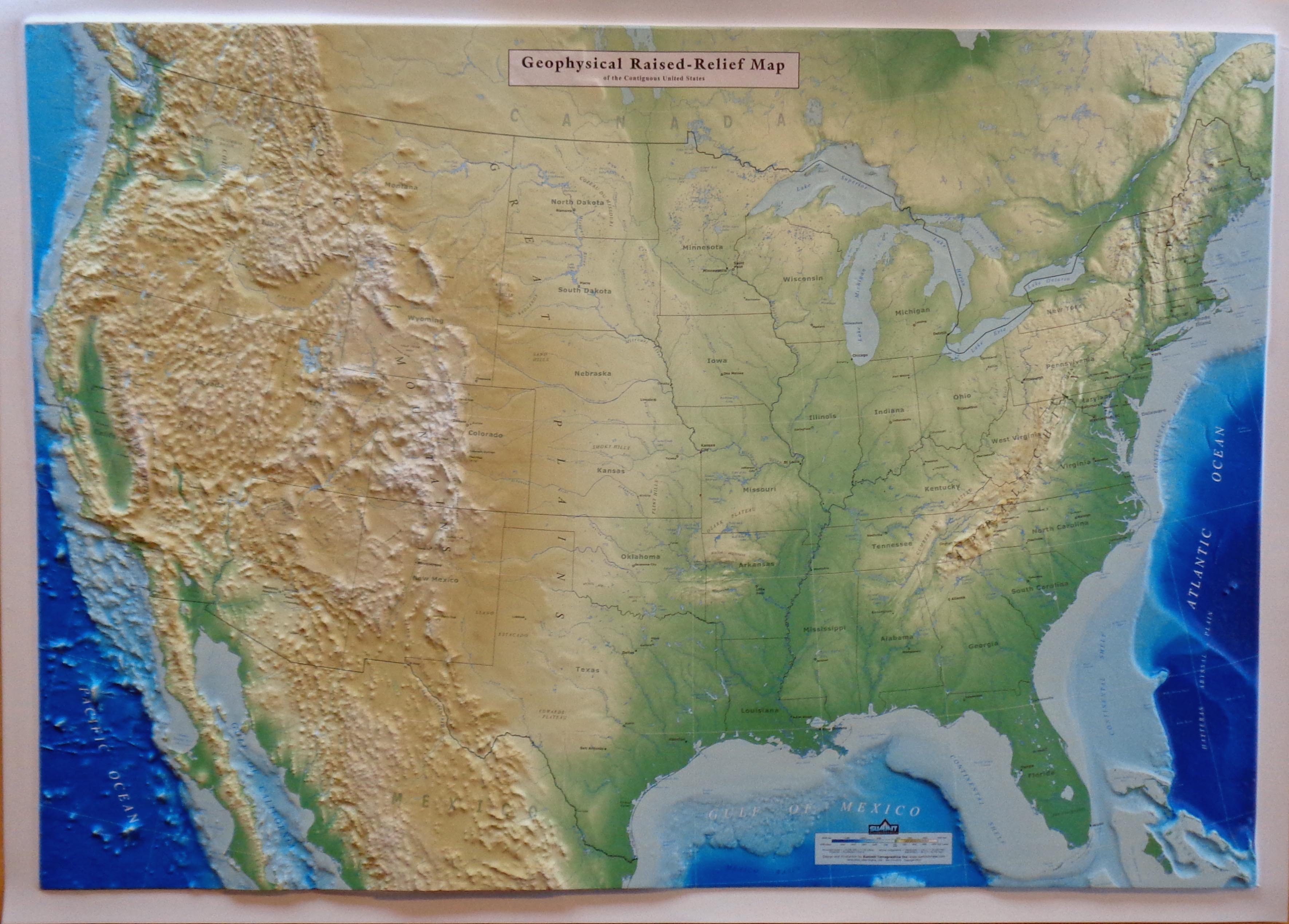
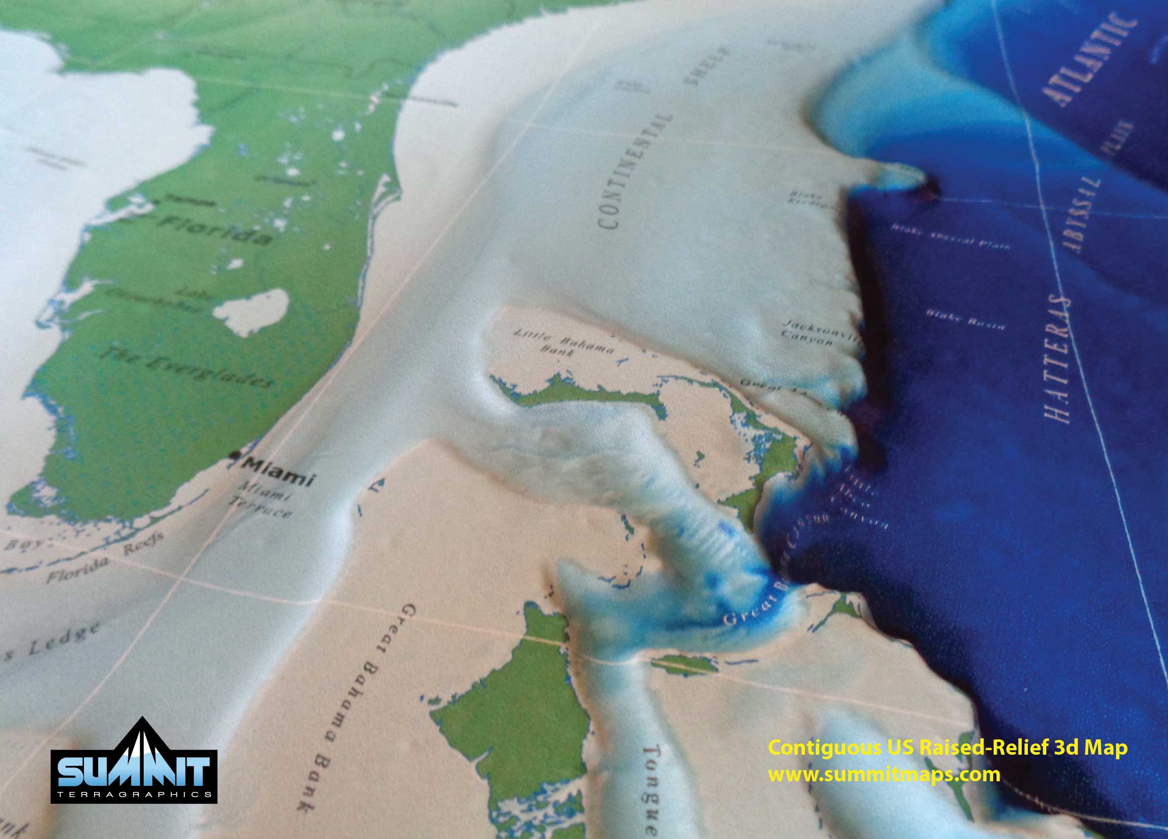
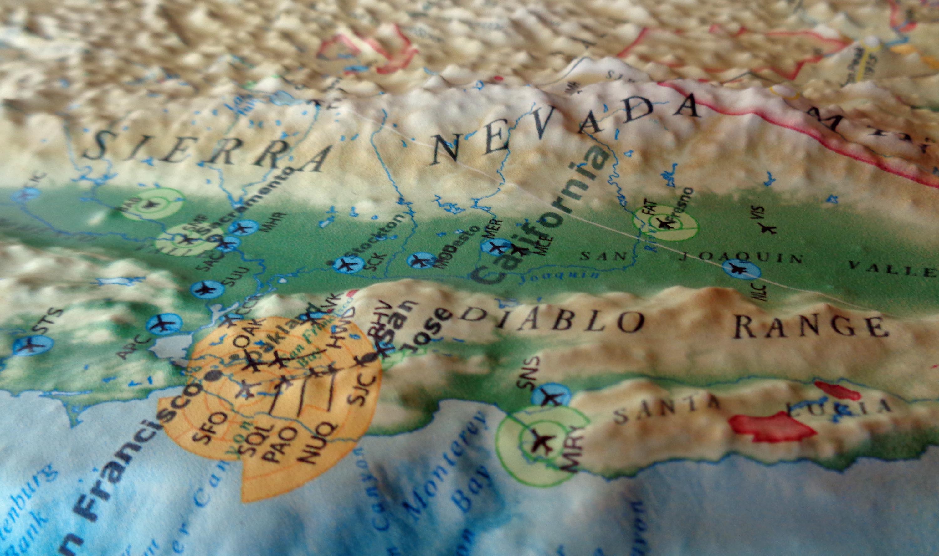
All of Summit’s raised-relief US maps model both the topography and surrounding seafloor bathymetry of the contiguous US within a three-dimensional model area of 40” x 28”. In addition to the physical modeling of mountains, plateaus and valleys, the maps’ base layer features an earthy color palette that emphasizes both dramatic and subtle changes in elevation above and below sea level.
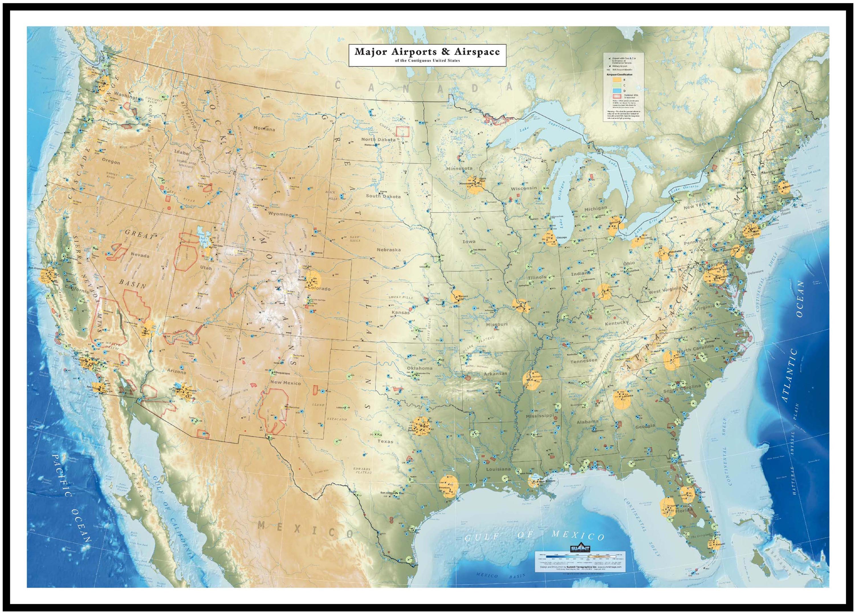
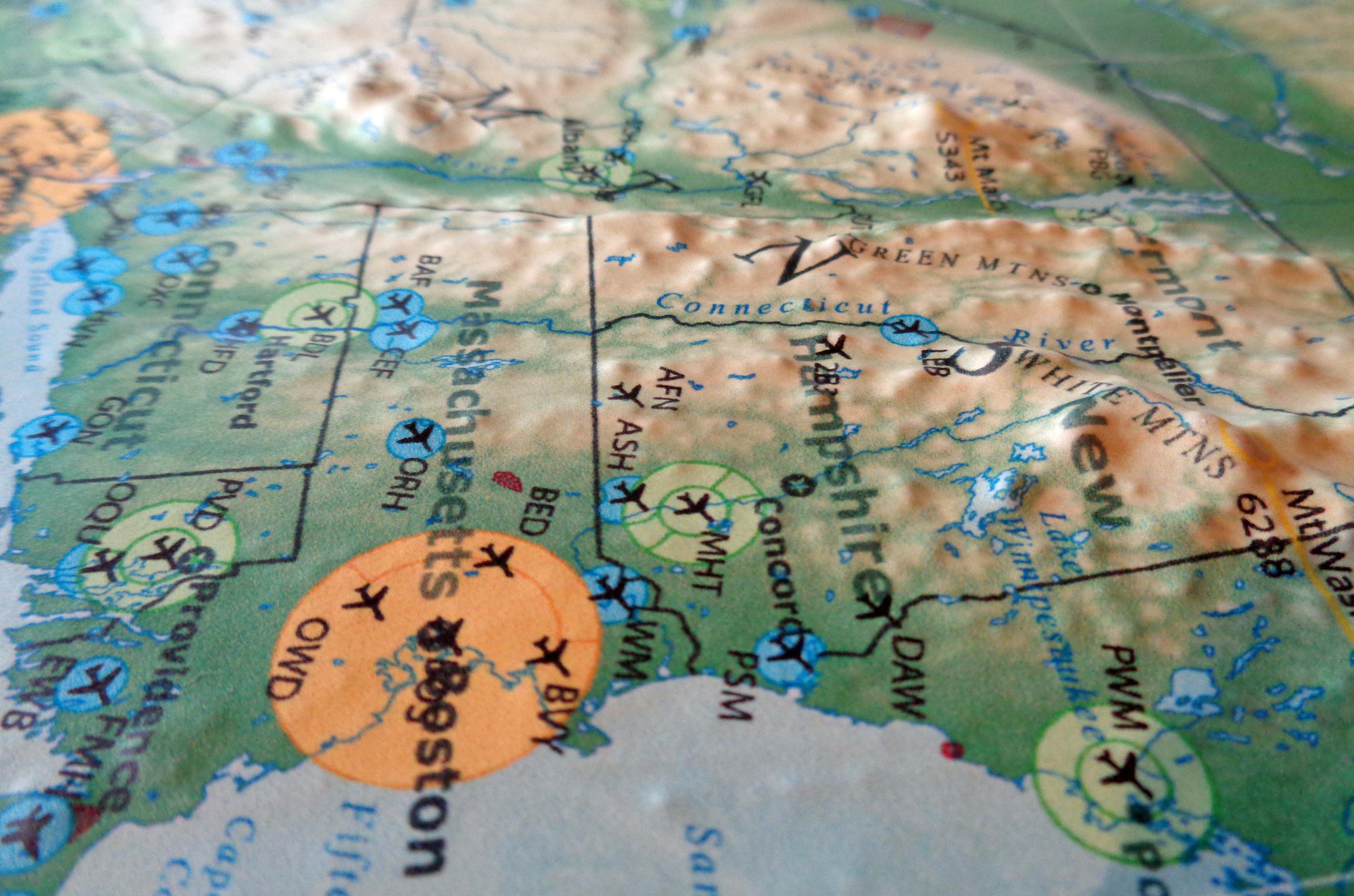
Annotations on the Geophysical US map identify major geophysical features, international and state borders, cities, and capitals, while the Major Airports & Airspace US map identifies airports with class B, C, or D airspace or with commercial service, as well as military airports. Prohibited, SRFA, and restricted airspace is indicated by shaded areas.
Summit offers these 42” x 30” US maps in three formats: unframed (poster style), mounted on foam board and frame-ready, or fully framed in a modern black anodized aluminum molding.
The maps retail for between $80 and $260 on Summitmaps.com depending on the framing options chosen, and will soon be offered on Amazon.com. Summit’s retailer partners are also beginning to include the 3D US map in brick and mortar stores. Sellers interested in carrying the new maps can contact Mike Higgins at Summit Terragraphics for wholesale pricing.
ABOUT SUMMIT TERRAGRAPHICS
Summit Terragraphics is an award-winning mapmaking company that has updated the traditional raised-relief map-making process to provide greater precision and image resolution, taking advantage of the latest digital technology and a proprietary tooling process. The result has been the creation of attractive and highly accurate 3-dimensional wall maps for home, business, and government use.
In 2015 Summit’s 3D map of Kauai, Hawaii, was awarded the platinum award for Best Overall at the International Map Industry Association (IMIA) Americas conference and went on to win the top Global Map Award at the IMIA Asia-Pacific conference in Brisbane.
Michael Higgins, Summit Terragraphics, http://www.summitmaps.com, +1 304-274-0978, [email protected]

Share this article